Posts Tagged ‘Cycling’


The last leg of my cycle south to the bottom of Sicily. Continuing on from where I left off in Napoli in 2002, I cycled south to Sicily, climbing Etna twice, and reaching the southern most point of Italy.

The trip started off at a volcano: Vesuvio, and ended on a volcano: Etna. On looking back at these photos, I discovered that I inaugurated my favourite cycling cap on this trip. 🙂
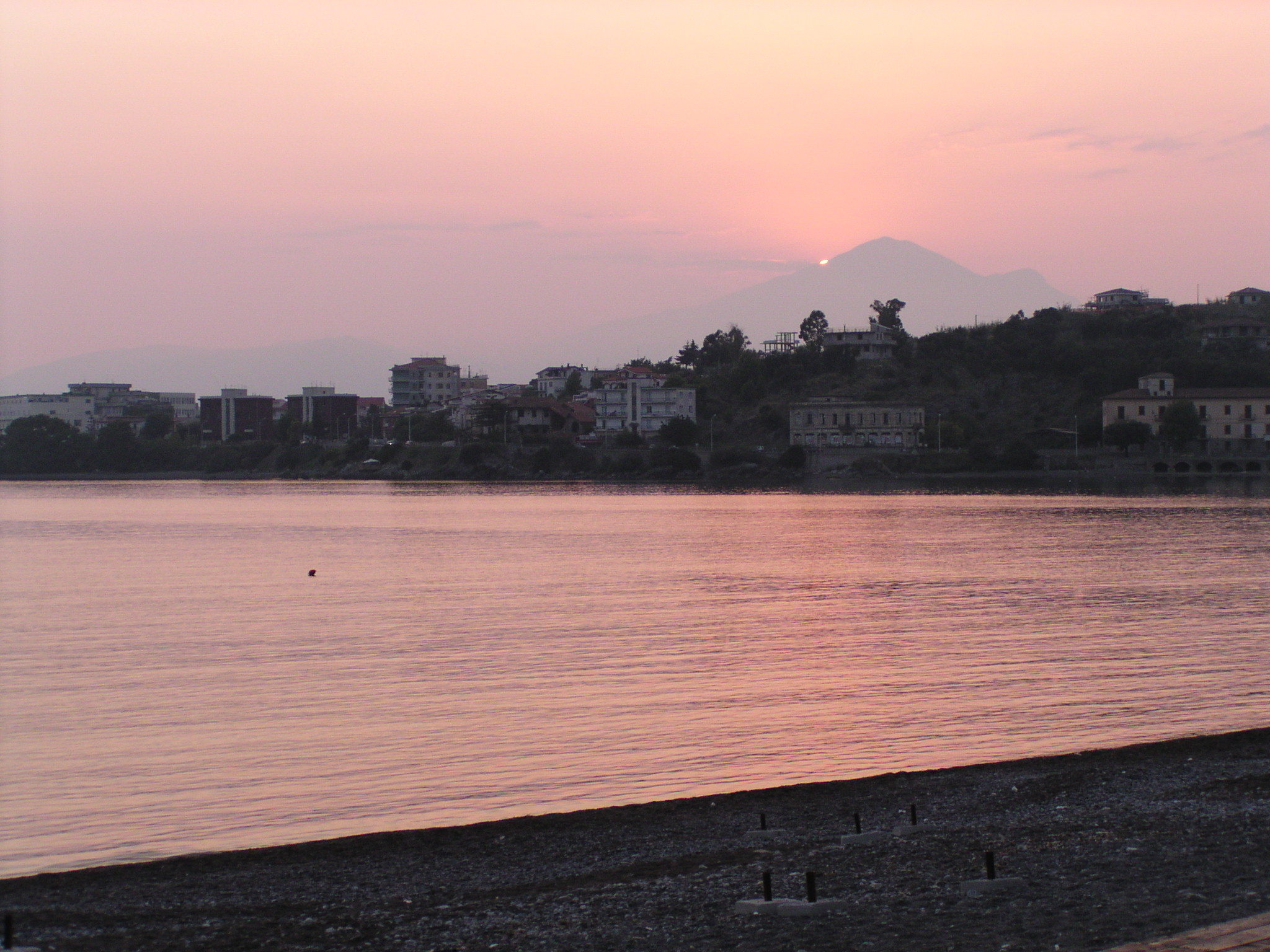
Vesuvio

Vesuvio

The trip followed the coast. Sometimes on roads winding up and down and around and around. Sometimes on main roads with lots of traffic. Sometimes on small roads that curved down into a valley and then wound their way back out: the same distance covered by 100m on the main road bridge. It was hot going in the Italian summer sun.

Coast road

Coast road

Coast road

Coast road

A long cut

A long cut

I had my fair share of beach places to stay. The stay on the beach at Fuscaldo was cut short when I discovered that I had left my passport at the previous night stop. An evening train trip back and forth. It was dark on the beach by the time I returned.

Fuscaldo

Fuscaldo

Tropea

Tropea

Tropea is a beautiful village perched on a cliff face overlooking a magical beach. It was lovely weather and a warm evening. I sat that evening at a pizzeria on the cobblestone market square. I remember that evening well, even though I am writing this 10 years later. The square was lit in a soft light from the lanterns. Happy couples were sitting facing each other over dinner and a glass of wine. Families were there, children playing, parents watching over them. Dinner took a while, but that was ok.

I sat. I studied the map, planning my route for the next day. I ate my pizza. I drank my drink. I returned to my hostel. I was tired, and my day was cycle, eat, sleep.

The cycling was fun. The scenery was nice. I was experiencing a lot. But, there was noone to share anything with. My boyfriend was home (he is not an avid cycler). I realised that such long distance trips were sometimes a lonely affair.

Also, southern Italy may not be my optimal cycling destination. It is hot, it is mountainous, and there is a lot of cycling on main roads with lots of traffic. This trip was my last long cycle trip until 2012. After this trip I started long distance running, and ran in quite a few marathons. The same physical exertion, in a shorter time span.

Then the boat over to Sicily, and up Etna: twice. From the hot, sunny coast to the cold, barren, lava landscape of a mighty volcano.

The ferry to Sicily

The ferry to Sicily

Lava on Etna

Lava on Etna

Etna

Etna

The road to Etna

The road to Etna

My friend Elke and her boyfriend were touring around Sicily at the time, and so I had a day off with them. We went to the beautiful Taormina.

Taormina

Taormina

Taormina

Taormina

Siracusa is another beautiful city in the south of Sicily. I spent a lovely evening there wandering around the medieval streets.

Siracusa

Siracusa

Siracusa

Siracusa

I arrived in the southernmost town on Sicily: Portopalo. I then made my way to Modica where I took the bus to Palermo. There were no camping grounds in the middle of Sicily, and I wouldn’t be able to cycle across in one day. And time was running short. My trip to the south of Italy was at its end.

And that was my last bike trip for nearly 10 years.
What made me decide to go on another long bike trip? Well, it was Norway. I was there in the winter of 2011, and I was captivated by Tromsø. I was there in the middle of winter when the sun only approaches the horizon and bathes the winter landscape in a deep blue twilight. I wanted to see this place again, but in the eternal sun of summer. Also, Norway is cold. No worries about excessive sweating. And the roads aren’t busy. Oh, and the scenery is absolutely spectacular.

On that trip in Norway, I didn’t experience the lonliness. I met lots of fellow cyclists. And, yes: blogging and facebook made me feel like I was sharing my trip with my loved ones. The wonders of modern technology! In 2013 I will be doing my longest bike trip yet. I am excited already!


Probably the last warm weather weekend of the year had to be taken advantage of. A bike trip in the autumn orange light, through forests of bright red and yellow leaved trees, their colours raining on me down as I cycled past. A 315 km trip from Eindhoven to Münster in Germany.

The plan was to cycle with Volker (who joined me on some of my cycle trip in Norway this summer) from his parent’s house in Rheine to Münster: the bicycle Mecca of Germany. On Saturday I put my head down and aimed at maximum kilometres in order to amble to Rheine on Sunday by noon, and then to Münster on Sunday afternoon.

I left Eindhoven on Saturday at 06:30 in the dark and headed north east. It was an overcast day as I cycled through the cow studded fields, and through the bright red forests with the trees shedding their leaves.

The bright red of the autumn forests

The bright red of the autumn forests


Enschede in the Netherlands was my distant destination, and I made it just before nightfall at 1830.

But Sunday was the gem of the trip. Starting misty, the autumn day turned sunny, warm and perfect. The mid afternoon light made highlighted beautiful contrasts in the forest and river surroundings. As the afternoon turned into evening, and the light softened to its mellow departure, the colours became rich and orange. What a lovely light to experience this beautiful nature.

Me near the Ems River

Me near the Ems River

The Ems River

The Ems River

The Ems River

The Ems River

Orange tree in the mellow late afternoon light

Orange tree in the mellow late afternoon light

Cycling in the soft evening ilght

Cycling in the soft evening ilght

Münster

Münster


Planning (at least the first draft of) the exact cycle route is an important part of the overall planning of a long distance cycle trip. Just ‘following your nose’ leads you to main, busy roads. Insider secrets remain secrets.

In the summer of 2013 I intend to cycle from where I live in Eindhoven, the Netherlands, to the North Cape, via the Baltic Countries. I have put together a planned route which is made up of documented biking routes, collected from a range of different sources. I have collected this route in gpx format which can be viewed on my iPhone.

Here, I would like to list the biking route sources, and how to concatenate such routes to the ‘mother plan’ route.

Sources of the cycle route

Netherlands

The Netherlands has a great infrastructure for cycling. There is a dense network of signed bike paths that connect numbered ‘nodes’ throughout the country. Each node is between 1 and 10 km apart, and from each node, there are signposted routes to each of the neighbouring nodes. There is a bike route planning website which calculates suggested routes between any nodes that you specify. I used this to calculate a route from my house to the start of the German section of the R1 bike path which I will follow most of the way to Tallinn in Estonia.

Germany

I generated the route crossing Germany using the cool bike route planner Naviki. Many thanks to Oskar from the Polish cycling forum for his tips for Mecklenburg Vorpommern.

This route replaced my original route following the R1 bike path
– a long distance bike path from Bolougne in France to St. Petersburg in Russia. The German leg of this bike path (along with a huge number of cycle paths across Europe) is available in gpx format on the Lonvia ‘bike overlay’ to the OpenStreetMap open source map project. Simply scroll to the area of interest and click on ‘Routen’ to see a list of the paths displayed on the map. A gpx file can be downloaded for each of these maps.

Poland, Kalingrad, Lithuania

In Poland I will follow the EuroVelo 10 bike path. I found the route for this on bikemap.net. Many thanks to Pawel and the people on the Polish cycling forum for helping me out here.

After following the coast to Gdansk, I will make my way to the R1 cycle route which can be downloaded from the Lonvia bike overlay as described in the German section. The Polish section is not completely covered, though. I used the gpx files which are from Detlef Kaden. This book/CD combination is excellent, giving route information, as well as info on things to see, accommodation, and visa information for the Kalingrad Russian enclave.

Latvia

For Latvia, I used a combination of gpx files from Detlef Kaden (see Poland section), as well as cycling routes from the Lonvia OpenStreetMap overlay (see the German section). See the section below on how the information from these two sources was concatenated.

Estonia

For Estonia, I used routes from the Lonvia OpenStreetMap overlay (see the German section).

Finland

Eurovelo is a planned network of long distance cycle paths crossing from one side of Europe to the other. There are 14 planned routes, which are shown here. The routes are in different levels of completion. For most routes, there is no information available at all. For the Finnish sections, there is detailed information given in the form of google maps. I downloaded these routes and converted them into gpx to add to my overall route. (I describe this conversion below.)

Sweden

The Swedish leg is part of the ‘Cykelspåret längs ostkusten’. The gpx files for this can be downloaded here. These gpx files outline a path up the coast. When the coast is left at the top of the Baltic sea, there as so few roads, I figured that no special attention needs to be paid to look for small cycling roads. I used google maps to create the paths from here up to the Norwegian border. (Converting google maps to gpx is described below.)

Norway

In Norway I will follow the ‘Sun route’ as described in the Lonvia overlay for OpenStreetMap (see German section).

Converting and merging gpx files

When cycling, I use EveryTrail to track my trip, as well as to follow the planned route. EveryTrail uses gpx files.

To create the ‘mother’ route, stored in gpx file format, I concatenated individual gpx files. This concatenation is described here.

Here is an instruction video of how to convert google maps (kml) files to gpx file.

Sometimes I only wanted a piece of the path contained in a gpx file. I did the editing by hand, joining two gpx files at the correct place by matching the latitude and longitude coordinates to find where the paths cross.


Updating some of my earlier bike trips. This was a beautiful ride in the sun in central Italy in 2002.

The trip southwards continued in 2002. Having made it to Pisa in 2001, this year I cycled with Frank Thiele southwards to Napoli.

Pisa – Naples 2002

Pisa is a hot spot for tourists. It is a lovely little village with the leaning tower and a host of other old buildings clustered together in the tourist area. Before we started on the adventure southwards, we needed the standard ‘we were here’ photo.

Starting point: The leaning tower of Pisa.

Starting point: The leaning tower of Pisa.

We followed the cycling route from Amsterdam to Rome by Benjaminse. It took us along gorgeous country roads in Tuscany. Rolling hills with beautiful old houses dotted on the crests, cyprus trees, and beautiful little villages. Tuscany is my highlight of all of Italy. Simply a stunning place.

Tuscany

Tuscany

Tuscany

Tuscany

Tuscany

Tuscany

Tuscany

Tuscany

Tuscany

Tuscany

Traveling with Frank, I learned that it was actually more pleasant cycling fewer kilometres, not the shortest route, and stopping on the way. With less testosterone in my blood as when I started cycling, without anything to prove, I realised that I didn’t need to cycle 200+km in a day. We could stop in beautiful little villages and sit in the sun. We could stop early and stay the night if it was a nice place. So, we visited some nice villages.

In the sun

In the sun

Bagnoregio is a charming town perched on a hilltop, surrounded by a city wall. In the middle of the beautiful, sundrenched landscape of central Italy.

Bagnoregio

Bagnoregio

And the landscape was flowered, this time in startling purple.

Purple

Purple

Purple

Purple

We skirted around Rome. Big cities are not very easy to navigate through, and it takes ages to get through them. We stopped at Tivoli to the east of Rome, and decided to plan in a rest day. Frank stayed around in Tivoli, and I caught the train in to Rome to do the tourist things.

Colosseum

Colosseum

After Rome, our planned route ended. Not having a recommended route means that you tend to end up on bigger roads, and pass through less pretty places. We followed the coast. We stopped one evening at the beach town of Sperlonga.

Frank in Sperlonga.

Frank in Sperlonga.

The coast leading into Naples was busy and ugly. Naples itself is an amazing, throbbing city. On cycling through Naples, I put on my yellow sunglasses, and somehow got an energy boost. I felt part of the bustling traffic. The cutting in and out of traffic. The tooting and waving of arms. I bounced down the cobblestone streets ringing my bell, living the moment.

We set up camp in Pompeii. This was the end of our journey. Our flight was booked a few days later. We had some time to cycle around the place. We cycled up Vesuvio one day (but took the metro to the base of the mountain to avoid the bouncy cobblestone streets). Another day we cycled along the Amalfi coast. The Naples area is gorgeous. The trip was continued in 2003.

Pompeii

Pompeii

On the way up Vesuvio

On the way up Vesuvio

The bike

The bike

The Amalfi coast

The Amalfi coast


I have now created a summary video of my cycle trip from Bodø to Nordkapp. Check it out!

YouTube video of the Bodø - Nordkapp 2012 cycle trip

YouTube video of the Bodø – Nordkapp 2012 cycle trip


In 2012 I cycled from Bodø to the North Cape (Nordkapp), a total of 1330 km, completing my bike tour of Norway started with Ed in 1997, when we cycled from Tønsberg to Oslo, and then to Bodø.

It was a spectacular trip. What were my highlights? There were many. Here are my top 4.

Highlight 1: The team of 4 met on the boat, and cycled together on the magical island of Senja. The weather was perfect, and our wild camping place on our own private fjord was spectacular. We bathed in the midnight sun.
Highlight 2: I climbed the almost vertical wall behind the village of Reine on the Lofoten islands to experience the most exquisite panorama. Moskenesøya at midnight.
Highlight 3: Skirting the northern coast on Austvågøya on the Lofoten islands on the way to Fiskebøl. Majestic mountains, fjords and serene tranquility.
Highlight 4: Arriving at the North Cape (Nordkapp). It was windy. It was cold. It was barren. And it was spectacular. I had made it. What a feeling!

Here is a day by day summary of the trip. I am interested to know which parts you likes. Click on like or rate on the individual day posts to let me know! 🙂

Day 0. To start in Moskenes Surrounded by pointy mountains and beautiful blue sky I set up my tent in Moskenes. Then I climb to the top of a peak above the town of Reine to experience the most exquisite panorama. Moskenesøya at midnight.
Day 1. Moskenes – Ørsnesvika. 131km The south of the islands are bathed in sun, the north in cloud, and I alternate between the two. Every turn reveals a new panorama.
Day 2. Ørsnesvika – Stokmarknes. 100kmSun, pointed peaks, fjords and tranquility. A highlight of the trip following the coast on Austvågøya island.
Day 3. Stokmarknes – Frøskeland. 73 km Cycling along the quiet north road on Langøya. I couch surfed with the lovely Svein near Sortland.
Day 4. Frøskeland – Andernes. 127 km The beautiful Andøya island was bathed in low hanging cloud. No midnight sun cycle, but ghostly scenery of pointy mountains in the mist.
Day 5. Andernes – Ersfjord. 80 km The team of 4 cycle along fjords, up steep long valleys, through tunnels into the wild and absolutely breathtaking scenery of Senja island. Wild camping on our own private fjord, we bathe in the midnight sun.
Day 6. Ersfjord – Tromsø. 94 km An early morning ride across Senja with not a soul around. Goal is Tromsø, and a hotel with curtains. After an afternoon sleep, I see the midnight sun looking out from above over Tromsø.
Day 7. Tromsø – Fosslv. 131 km. Rain as I cycle the road I passed in the winter with Dad and Valerie. A race against the clock to catch a ferry. An afternoon of amazing threatening clouds hanging low over the mountains. And no more rain.
Day 8. Fosselv – Alta. 161 km Mountain passes and a long road along the fjord. 50 metres up and 50 metres down, 30 metres up and 30 metres down. All the way to Alta. Exhausting. And then another broken spoke. The spoke problem is now serious.
Day 9. Alta. 40 km No bike mechanics in Alta, and my spoke replacements aren’t doing the job. An attempt to leave Alta failed, and I return, dejected, not knowing what to do next.
Day 10. Alta (car: Hammerfest). 11 km A car hired, 130 km driven, and a new wheel bought in the northerly town of Hammerfest. The bike is now OK to continue.
Day 11. Alta – Repvåg. 153 km. High tundra plain and windy coastal road. The North Cape is approaching!
Day 12. Repvåg – Nordkapp – Honningsvåg. 118 km The Nordkapp tunnel, and then a windy, hilly, chilly, and beautiful slog to the North Cape with Chris. Goal achieved! I am happy!
Day 13. Honningsvåg. 0 km Down day in Honningsvåg. Cups of tea, talks with Chris, and a 50 metre dash through the rain to the supermarket.
Day 14. Honningsvåg – Kjøllefjord – Mehamn. 39 km Journey in the grey to the Nordkyn peninsula. A bleak, barren and windswept place. Beautiful!
Day 15. Mehamn – Slettnes – Kjøllefjord. 72 km The most northern lighthouse on mainland europe. Another broken spoke, and a drenching, cold, windy return towards Kjøllefjord.

Results of today.
Broken spokes: 1
Malfunctioning speedo: 1
Drenched shoes: 4
Bedraggled cyclists: 2
Interesting people met: 4
Northernmost lighthouses seen: 1
World’s most northern forest seen: 1
Bleak, desolate, tundra, arctic, beautiful landscape seen: lots
Wind: yes. strong headwind/side wind
Rain: yes
Reindeer seen: lots
Waffles eaten: 2 each
Happy cyclists: 2
Nice warm, snug hut: 1

On the high plains

On the high plains

Slettnes

Slettnes


Slettnes

Slettnes


Today had everything. Sleep, eat, sleep, cup of tea, pack, cup of tea, contemplate belly button. It also had having a drink out of glasses made from ice in a bar made of ice. It had a lazy ride on the luxurious Hurtigruten boat from Honningsvåg to Kjøllefjord. It had an awesome ride through the most barren landscape yet. A climb to a plain of grey, rolling rock, patches of snow, and lakes supplying streams running down into fjords. It was cold, grey and wet, and blowing so strongly that the Hurtigruten wasn’t stopping at all the ports, and had cancelled some of the excursions. Luckily the wind was a tail wind that blew us on to the high plains. Near Mehamn – our final destination – it was a side wind. I had to concentrate completely to not be blown off my bike, scooting down the mountain.

Me and Chris in the Ice Bar

Me and Chris in the Ice Bar


Chris and me in the Ice Bar in Honningsvåg.

The Ice Bar

The Ice Bar


Me in the Ice Bar in Honningsvåg.

Cycling up the high plains

Cycling up the high plains


Cycling up to the high plains.

On the high plains

On the high plains


On the high plains.

Mehamn is a lovely place a million miles from anywhere. Another little village sitting on a bay surrounded by a desolate arctic moonscape, the place has charm. Feeling cold and wind swept, we stopped at the first sign of a room for the night, to be greeted by a lovely, lively South African working at a place called Red Tree. They had rooms but also lots of interesting knick knacks. He enthusiastically told us that Mehamn was the best place in the world. Amazing scenery (which is true) and great things to do – winter and summer. In the winter you can go kite skiing. This would be fantastic on the endless rolling tundra plains with the gale force winds. March is the best month. Anyway, he had no rooms left, but arranged us a room in the local hotel and the following night in a Sami camping ground near Kjøllefjord.

We didn’t stay longer as I was slipping into hypothermia, and we made our way to the hotel and I had a super long shower to warm up.

I like Mehamn and this peninsula.


Today it rained all day and blew a gale. I exhibited the feline side of my personality. I slept and ate. Periodically I looked out of the window. This convinced me to remain in this feline mode.

Chris and I slept in, had a late breakfast and many cups of tea. We wanted to at least set foot in Honningsvåg centre (and not just be in our lodge on the outskirts). We went outside, dressed for the rain, ready to walk the 3 km to the centre. After 10 metres we returned. At that point a couple of drenched French backpackers arrived. That was it. Time for an afternoon snooze.

At a certain point, in a feline way, we decided it was time for dinner. We cooked up our North Cape meal than we took all the way to the North Cape and back. Anything else would have involved a dash in the rain to the supermarket.

But, we did need to go to the supermarket. After hours of procrastination we made the dash.

Despite the bad weather forecasts, we plan to do a short trip on the neighboring peninsula. We needed supplies. Sweet tooth Matthew was calling the shots.

Sweet tooth at heart

Sweet tooth at heart


We then wanted to go to the famous Ice Bar to celebrate our achievement of reaching the North Cape. But we were not going out there in the rain. Time for a taxi.. 🙂

The Ice Bar closes at 20:00 – even on Friday night. (!) We ended up in the Nøden bar which was probably much nicer. A local bar.

Snooker

Snooker


A wonderful rest day with lots of chats and cups of tea. Almost a highlight of the trip..


Wow! So much awesomeness packed into one day it makes my head spin! The strongest headwinds to date as I crawl up the windswept, barren coast from Repvåg to Honningsvåg to meet up with Chris for lunch. Beautiful and worthy of a final approach to the end of the earth.

Leaving Repvåg

Leaving Repvåg

Leaving Repvåg

Leaving Repvåg

Then, entrance to the final approach is only granted to those that can pass ‘the tunnel’. A 3 km dive to 212 m under the sea at 9% slope, followed by a 9% climb to materialize in the rocky, mountainous spectacular Magerøya island.

Entering the tunnel

Entering the tunnel

I stop at the entrance to gather myself and eat a chocolate bar or 5. The wind is howling at the entrance and a periodic electronic chime sounds from the mouth of the tunnel as if to warn those that dare to enter. A car emerges from the tunnel and a Swedish couple get out. ‘it’s long and steep,’ they warn, ‘and no room to walk your bike!’ They look concerned for me. I know what I am doing, I reassure them, and plunge in.

I pass the roll down gate 20 m inside the tunnel that opens and closes in the winter to let the individual cars pass, and then accelerate to the depths. Faster and faster, and I get colder and colder. I start to shake from the cold and my teeth start to chatter as I accelerate down and down into the dead straight tube.

In the tunnel

In the tunnel

When cars pass its like an enormous train passing by just over my head. Then, it’s silence once more. Just the whirring round of my wheels.

I am glad when I reach the bottom and start cycling out. I can warm up. It gets steeper and steeper as I slog forward in low gear. But, there is no headwind: a blessing.

Following the coast, now on Magerøya, I crawl along further into the wind before entering another long tunnel. This time it was must less strenuous. A gentle climb for 2 km and a gentle drop, again without wind. I start whistling, making an orchestra of sound echoing off the walls from all directions. A tribute to mum. All her favourites. She whistled all the time.

I arrive at Honningsvåg and enter the Nordkapp guesthouse (quite a common name in these parts). Chris is upstairs in the communal area reading a book in the warmth. We sit and a chat, comparing stories of this trip and others, and made plans for the day. Cycle the last 30km to Nordkapp and then a walk to Knivskjelodden for dinner. This is the true most northerly point of Europe: a low lying peninsula one bay across from the Nordkapp. A 9 km walk from the carpark. We go shopping, planning to cook up a feast on the most northerly point, watching the bus loads of tourists on the Nordkapp.

We talk and talk, and laugh, and before we know it, it is 15:00. We need to hurry. We still want to do a lot.

The final assault can only be completed by those that have made it this far. The wind is brutal, as are the long steep climbs: up and down and up again. During the whole trip from the Lofoten islands to here, I have had a head wind. The gods smile on us today and dish up a hurricane that is conveniently a tail wind on all up hill stretches and a ferocious head wind going down. On the flat bits it is often a side wind.

Wind

Wind

And, man, it is beautiful scenery. A winding road through rugged, barren, rocky land. Grass and moss. Rocks and stones. Lakes and fjords. Herds of reindeer. Sweeping views before dropping down along the road curving down to the bottom.

Towards Nordkapp

Towards Nordkapp

Towards Nordkapp

Towards Nordkapp

Towards Nordkapp

Towards Nordkapp


The last grunt to the Nordkapp is with a side wind and we freeze to death. We stop at the start of the walk to Knivskjelodden and hide under the shelter out of the wind for a snack. Then up and up. We get a discount entrance to the North Cape complex. Cyclists are classified as British students and get the reduced rate. We pass through the village of camper vans and buses and into the warmth.

From inside we look out the glass at the globe which everyone photos when they come here. That is for later. First a hot chocolate, a waffle, and soak up the warmth.

Well, dear readers. Here is the proof picture. Chris and I at the North Cape.

20120720-092220.jpg

It is too cold and too late to go to Knivskjelodden, and so we have dinner at the restaurant at the end of the universe and make our way back.

We remark over and over with glee how perfect the direction of this hurricane wind is. Perfect head wind to brake our steep descents and perfect tail wind on the climbs. We whiz on home in 2 hours. A snappy time for 30 km in Norway.

Content, I curl up into bed.