Posts Tagged ‘Cycling’


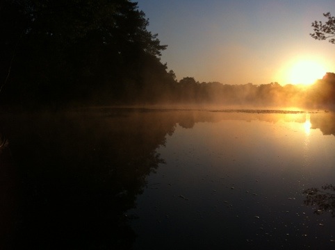
My last training trip before the big, exciting trip in Norway next week. It was a perfect day for cycling. The weather forecast was for 25C and partly cloudy. I got up before the crack of dawn to be able to cycle in the cool stillness of the early morning. A serene time of the day.

20120701-064553.jpg

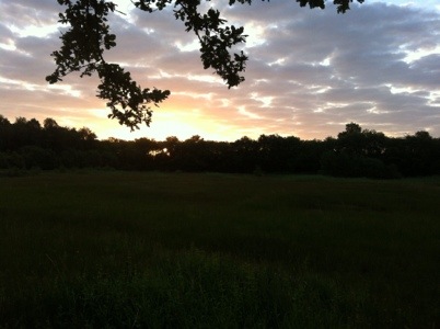
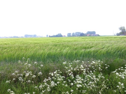
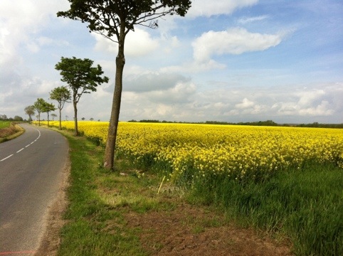
It was cool and hardly a breath of wind as I passed through fields, sleeping villages and green green forests. The Malpie marshy nature reserve was alive with birds squawking as they circled over the water looking for fish. And then I joined my favourite canal in Belgium: the one I run along when I run to Weert. This time I was to follow it all the way to Maastricht.

20120701-065239.jpg

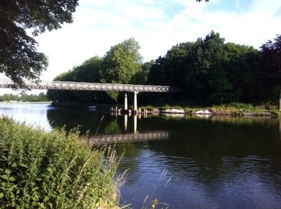
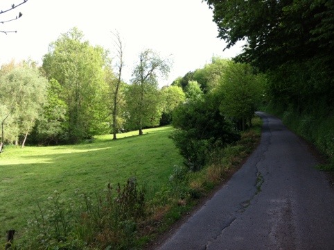
The sun rose in the sky, but I stayed in the beautiful shade under the leafy trees that lined the side of the canal. A head wind picked up but was nothing compared to my slog along the coast in Belgium a month ago.
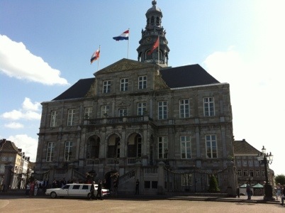
I arrived at Maastricht at 11:30 and had a nice lunch on the main square in the sun.

20120701-065616.jpg

It was time to rest in the hottest part of the day, and I made it to a swimming spot on the Maas and lay there and read, going for periodic swims until 15:30. The last part of the trip was going to be hilly, and I didn’t want to do it at the hottest time of day.

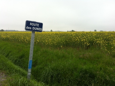
I made my way to Aachen along the lovely scenic but very up and down route that hugs the border with Belgium. Holland does have some steep hills and some cute little villages tucked in cosy valleys. Epe and Slenaken are like this, and are very pretty.
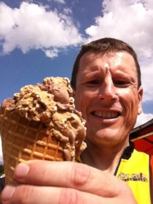
I stopped at the famous huge ice cream place in Epe. They were busy, a hoard of cyclists having just arrived.

20120701-070138.jpg

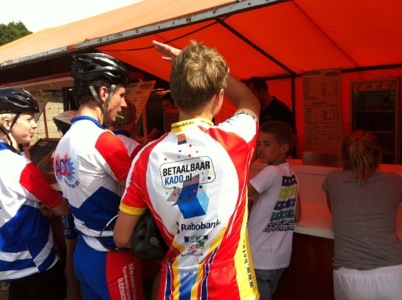
I got the third size of ice cream from a total of 7. They have 1, 2 scoops, giant, mega, giga, ultra, and super ultra.

20120701-070445.jpg

Some dark clouds crossed the sky, for which I was grateful. I could climb my way up to the Vaals ‘mountain’ – the highest mountain in the Netherlands – in shade. It is at the point where the borders with Belgium and Germany meet. From there it was all downhill (as I know a route that is like this) all the way to Cristina’s place, situated at the lowest point in Aachen.
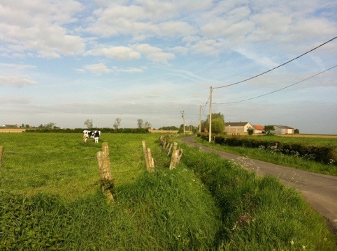
The whole family will cycle a bit tomorrow. A pleasant day excursion.


I have just added the second leg of my Italian cycle trip. Check it out here.

The top of the Gottard pass. It was cold.

The top of the Gottard pass. It was cold.


The first leg of my cycle from Aachen to Sicily is now online. I cycled in 2000 from Aachen to Andermatt in central Switzerland just before the Gottard pass over the alps. Later legs of this trip are to follow.

Veloland Route 3

Veloland Route 3

Cycle trip: what to take

Posted: May 22, 2012 in Cycling
Tags:

I went on a 4 day cycle trip through the Netherlands, Belgium, France and England over the ascension day long weekend. One of the goals of the trip was to test out all the equipment and clothing I plan to take for my cycle trip to the North Cape in Norway. I took some notes of equipment that needed to be repaired, and things I need to buy for my trip. Better find out now before I leave for Norway.

Here is a list of what I intend to take to Norway

  • Bike panniers (2 front and 2 back)
  • Plastic waterproof iPhone holder for handlebars
  • iPhone
  • iPhone charger
  • Earphones for iPhone
  • 2 portable batteries (2 x 5000mAh Lenmar PowerPort Wave) for charging the iPhone.
  • Poncho
  • Trekking pants (light, fast dry, zipper to turn them into shorts if the weather is right)
  • Fleece
  • Wind jacket
  • Down jacket
  • 2 Cycling shorts
  • Lycra long running pants (wear over the cycling shorts in cold weather)
  • Cycling gloves (for stopping blisters on the hands)
  • Warm waterproof gloves
  • Buff
  • Cycling tricot (1x short sleeve, 1x long sleeve)
  • Helmet
  • 2 water bottles
  • 4 underpants
  • 3 t-shirts
  • singlet
  • Benie
  • Teva sandals
  • Warm, waterproof, hard soled, light weight hiking shoes (can cycle in them, can be evening shoes, and can do short several hour hikes with them on the cycle trip)
  • Waterproof shoe covers
  • Socks (2x warm wool, 1x cooler)
  • Towel
  • 1 cap
  • 1 mosquito head net
  • 1 pair of sunglasses
  • Small, compactable pack to be used as rucksack for short hikes are errands to the shop etc.
  • Long sleeve inner layer for upper body
  • 1 heavy duty bike lock
  • Bike repair kit (for punctures, replace inner tube, repair broken spoke, oil)
  • 1 bowl
  • 1 plastic cutlery set
  • 1 swiss army knife
  • Tissues
  • Toiletries
  • Toilet paper + alcohol hand wash
  • Ear plugs
  • Sunscreen
  • Lip balm
  • Pen
  • Torch
  • Tent + plastic sheet for under the tent
  • Sleeping bag
  • Thermarest
  • Thermarest repair kit
  • SLR camera (+ extra batteries and charger)
  • Medical kit
  • Needle and thread
  • DEET insect repellant
  • Lighter
  • Maps
  • Food

I haven’t done a long trip like this in many years, and not one in the far north since 1997. Please, give comments and advice on extra things to take!


Eindhoven – Dover – Oostende

Hi all. Here is my complete trip on the ascension day long weekend bike trip. It looks more impressive I think with each day’s trip concatenated together.. 🙂


Dover – Calais – Oostende

The weather had changed completely when I got up this morning. Thick cloud and a gale was blowing damp cold air from the north-east. Like in Calais I did a few circuits of the bitumen harbour passing passport and ticket checks, and lining with the cars. I stayed inside the boat this time. Too chilly outside.

I found the way out from the harbour easily and started my slow slog to the north-east. In the open fields without protection from the wind I travelled at 13-14 km/h. With a few trees for protection I made 15. Villages were a blessing. I made 17-18 km/h. The constant push forward is more wearing than the varied pushes uphill and rolling downhill of the earlier days. Also, going uphill, you know you will be cycling down. I knew the wind would be blowing in my face all day today..

20120520-221715.jpg

20120520-221928.jpg

Also, roads were again an issue. Near Dunkirk everything was almost freeway. I took a detour south and made my way through some much more pleasant villages. It was time for a late lunch at the Belgian border. A wacky brasserie playing a mixture of 80s, schlagers and 60s and frequented by the local elders was my stop for lasagne.

It became clear to me that Oostende will be my final destination and not Vlissingen. The wind, if anything, seemed to get stronger. I was reduced to 11 km/h at times. The wall to wall high rise apartment blocks of almost all of the Belgian coast were a blessing. Near them I made 18 km/h.

20120520-223304.jpg

I arrived at Oostende ready for a lazy sit in the train. I feel satisfied having seen some new country out in nature.


Heuvelland -Dover

It didn’t rain overnight and the skies were surprisingly clear when I emerged early from my tent. The birds were already up proclaiming their deafening chorus. It was 5am. I packed up, ate my few remaining snacks (they didn’t have anything much to buy at the camping ground the evening before), and left.

Again, cycling early in the morning is the best time. The air is cold and crisp and there is a magic light. I took the back roads to Loker and the nipped across the border to Bailleau – a very quaint town, and so peaceful so early.

I nourished myself on wares from the boulangerie today at various stops. Lots of naughty pastries. It is France, after all. There was little else. They were very good.. 😉 Anyway, I’m sure the calories are burnt off..

The wind was predominately a head wind and the hills seemed more up than down. I had a slow pace, but it was nice, cool, cycling weather, the sun poking through the clouds from time to time.

Finding a road not impossibly busy with cars and trucks rocketing along is quite a challenge. At times such roads were unavoidable and rather unpleasant. The side roads were all the more rewarding. Narrow, meandering roads, flanked by fields and cows.

20120519-203524.jpg

20120519-203704.jpg

The uphill rolling hills unexpectedly dipped precipitously into the town of Licques. It is a beautiful village at the bottom of a bowl of circling steep hills. What was it doing here? Lovely. Lunch at Licques, and then a short slog until the pass, from which I rocketed down all the way to Calais.

The harbour and all the infrastructure for the ferries is very impressive. After lining up with the cars, I had a restful trip across the channel before admiring the white cliffs on the way in to Dover.

20120519-202620.jpg

My plans of doing the cycle trip on the cliff top to Deal didn’t happen. I circled around and around in Dover before slogging my way up and immensely steep road to the castle on the hill. The road was so steep the front wheel almost reared up, nearly flipping the bike. I cycled briefly along the top before chatting with a guy sunning himself on a grassy area at the top. I realised Deal was way too far and steep. In fact, I decided to sleep in a hotel in Dover. Much more convenient than the planned camping ground at Folkestone. A good English roast for dinner and then off to bed. Early boat back to Calais and the up the coast as far as I can get.


Waterloo – Heuvelland

I woke to the pitter patter of rain on my hotel window. It was grey and wet outside. I went back to sleep. It was 4am.

It had stopped raining by the time I left, and within 2 hours all clouds had evaporated and the sky was clear and blue.

The Vlaanderen long distance bike trip tries to avoid main roads. A good thing. When it gets hilly, though, this means you are lead up and down and up and down. North, south, east, west. Very pretty, green steep valleys. Cute farm houses. Cycling through fields of grain. You feel, though, that you aren’t advancing. Just getting tired- up and down. So, I took short cuts – the main road. You get forward, but the constant rush of traffic is annoying. I took a balance which worked out well.

20120518-210124.jpg

I had a tasty lunch in Brakel. The lovely woman serving spoke Dutch, but I didn’t understand a word. She was very friendly though.

I learned of the Flemish Ardennes today. Serious hills with serious slopes. Geraardsbergen was the hilliest. My pace was slow. After Kortrijk the hills ended and I followed a river that was the Belgian French border. The dark clouds made for an imposing backdrop.

I am at a busy camping ground in Heuvelland, near the French border. A simple dinner and I am full. Calais and England tomorrow.


Eindhoven – Waterloo

I left mounting the front wheel pannier carriers until the last evening. This was a bad idea. I couldn’t get them mounted. I needed to be able to make a screw shorter by sawing it off. I gave up, and left with only the rear wheel bags. My test of packing the bike with all the equipment for Norway will have to wait until next time.

I was excited to leave and was awake super early. I was on the road by 5:30. It was cold and overcast. I cycled with long cycle pants and 2 layers on my torso. I made a note that for Norway I will buy warm and sturdy (and waterproof) shoes for cycling. And, I noted to bring warm gloves next time.

There was low hanging mist suspended over all the lakes. In the early morning it was a beautiful light with the sun hanging low. The birds were tweeting and the world was still sleeping. It was just me to see this glorious morning.

20120517-214502.jpg

The world slowly started rising. I passed (or actually was passed) by lots of packs of cyclists as I cycled along the canal, lined with rich green trees. I turned south and followed the long distance cycle route southwards. I passed along canals, then cute farmer villages and finally along a straight stretch of bike path that used to be a train track. I passed Tienen and then some beautiful forests.

I expected the hills to increase as I got further south. This was true in general. The hills came in patches. And some were tough. One just out of Tessenderlo and one just out of Tienen. In between it was flat and easy going, made a bit more difficult with a slight head wind.

I was getting hungry, and my iPhone was running out of juice. At 16:30 I pulled up in Overijse and had a tasty lunch/dinner. The only camping ground within reach was in Overijse itself. It turned out to be closed. I decided to stay in a hotel. I am now in the rather ugly Waterloo, just south of Brussels.


There are lots of apps for tracking a route for running, cycling, hiking etc. Each have different features and with different target users in mind. For tracking my bike trip from Bodø to Nordkapp I am looking for an app that

  • is easily integrated into my wordpress blog and looks good there
  • can be uploaded and inserted into the blog easily from an iphone
  • uses as little battery power as possible (as I will be going long stretches without power)
  • allows photos to be uploaded and tagged en route

I have tested the following tracking apps with my morning run: EveryTrail, Cyclemeter and GPSies, and tried to integrate them into this post. I have written my impressions of each app, and how I incorporated them into the WordPress post.

EveryTrail

Incorporation in WordPress

Link to EveryTrail map

As WordPress does not allow embedding, it is a bit of effort to get this to appear properly on the post. This post tells you how.

In short: on the EveryTrail site, go to the track you want to post on WordPress and copy the text for “Share this trip – Flash map with photos for websites and blogs”. Paste this into the HTML editor of WordPress, and then replace the word embed with gigya and change some brackets in the HTML code.

Impression

I have been using EveryTrail for about 2 years now and have tracked many trips with it. The user interface during running is easy to use. It is possible to take photos while running and have them automatically placed on the resulting map. It is also possible to embed the map into WordPress, even from the iPhone. All the runs/cycles I record can be made searchable and available for the general public.

For training runs where the goal is to improve your time, compare a run with earlier runs in real time, run a particular interval training, or follow lots of data while running, EveryTrail is not the app. There is little real time information in EveryTrail, and it is hidden in a different tab to the map tab. For my Norway cycle trip, these features are not needed. I have decided to use EveryTrail to track my trips in Norway.

Cyclemeter

Incorporation in WordPress

Cyclemeter uses googlemaps and it is possible to incorporate a googlemap into WordPress. It is not done by pasting the googlemap URL address into the code but rather, as explained here. This can be easily done using the web-browser interface of WordPress, but is not easy using the iPhone. (One way of incorporating a googlemap using the iPhone can be done via email postings. Such postings are difficult to edit before publishing.)

Impression

Cyclemeter is very customizable and can display all sorts of interesting data real time. This is ideal when training for a marathon for example. I also like how it puts kilometre markers on the map.

It is, however, not trivial to write a post and incorporate a Cyclemeter map in the post using an iPhone. Also, the maps are not searchable and usable by the general public, which I think is a shame. It is not possible to incorporate photos.

GPSies

Incorporation in WordPress


GPSies uses OpenStreetMaps. There is a plugin that can be used to incorporate the GPSies map onto the WordPress post. Plugins are not allowed on blogs hosted by WordPress (all the free blogs), and so you need to arrange a different blog host in order to use this option.

Alternatively, it is possible to convert the map to KML format on the GPSies site, and import into google maps as described here. The resulting googlemap can then be incorporated into the post as described above for Cyclemeter. My 10km run seemed to be truncated in the resulting googlemap. I am not sure of the cause of this.

Impression

Like Cyclemeter, GPSies can display more real time data than EveryTrail. It is even less trivial than Cyclemeter to incorporate the resulting map into a WordPress blog using the iPhone. The resulting maps are searchable and usable by the general public. It is not possible to incorporate photos.

I found it very irritating with GPSies that it is impossible to scroll away from your current position on the real-time map while you are running. I think it is important to be able to do this to be able to see where you plan to go (cycle/run) next.